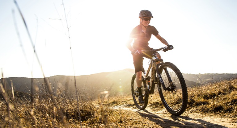
Great Places to Ride in The Valley
Pick the Right Ride for You!
We’ve compiled a map of our favorite local rides and routes to share with you, enjoy!
Consolidated Canal Path
The Consolidated Canal Path runs north–south along the entire length of the Consolidated Canal, an 18-mile-long waterway dating back to 1891. The route consists of both a paved path and a gravel-surfaced trail—more popular with horseback riders and joggers—on opposite sides of the canal for all but two short stretches: only a gravel path is available between Warner Road and Lindsay Road in Gilbert and from Riggs Road to Hunt Highway in Chandler.
The gentle-grade path connects Chandler (where it is also known as the Paseo Trail), Gilbert (known here as the Heritage Trail) and Mesa as it winds through neighborhoods, farms and parks. Waterfowl and fish can be spotted in the canal, and fishing is permitted. One highlight along the route is the Paseo Vista Recreation Area in Chandler, a 64-acre park atop a former landfill that offers a large archery facility, playground and disc golf.
In Gilbert, trail users can pick up the Western Canal Path to head towards Phoenix. From the trail's northern endpoint in Mesa, continue west on the Tempe Canal Path or head north on the Southern Canal Path to enter the Salt River Pima–Maricopa Indian Community.
Highline Lateral Canal Path
The Highline Lateral Canal Path runs along its namesake waterway through the Arizona cities of Phoenix and Tempe and the smaller town of Guadalupe. Open in several disconnected segments, the trail features both paved and gravel-surfaced sections, and the scenery varies from suburban homes to shopping centers to open fields with views of nearby hills.
The longest continuous portion runs between W. South Mountain Avenue and Interstate 10 in Phoenix, although a tricky crossing of E. Baseline Road is a challenge on the eastern end. The trail has been improved with a paved surface on the south side of the canal between E. Baseline Road and S. Central Avenue along this stretch, making it the most popular with local residents. Just off (and reachable from) the trail, both Francisco Highland Park and Circle K Park offer recreational amenities, picnic areas and restrooms.
Eastern Canal Path
The Eastern Canal Path spans the entire length of its namesake waterway through Mesa, Gilbert and Chandler in suburban Phoenix. The trail, which at times has a smooth paved surface and at others a coarse gravel, provides access to nearby residences, schools and parks.
In the north, the unpaved path continues along the South Canal as the Southern Canal Path, in turn providing access to the massive Arizona Canal Path in the Salt River Pima–Maricopa Indian Community. Take that trail westward to reach Scottsdale and Glendale.
Rio Salado Pathway
"The paved Rio Salado Pathway runs along both banks of the Salt River in Tempe. The generally dry waterway was expanded into Tempe Town Lake in 1999, and the scenic waterfront area is now a popular recreational, residential and commercial destination. Often, the trail is referred to as the Tempe Town Lake Trail.
On the lake's south side, the trail connects Arizona State University's main Tempe campus with Tempe Beach Park, as well as the Tempe Marketplace retail mecca. A newer extension on the trail's eastern end continues the trail behind the Tempe Marketplace and under the State Route 202 and 101 interchange to an end at Riverview Park in Mesa. Sloan Park, the spring training home of Major League Baseball's Chicago Cubs, was recently built in the park, bringing massive crowds to the area on game days.
The trail is shorter on the lake's north side, but it serves the Tempe Town Lake Marina and provides a critical connection to the Indian Bend Wash Path at its eastern end. Trail users can extend their trip by taking that trail north all the way into downtown Scottsdale.
A bicycle and pedestrian bridge links the two paths over Tempe Town Lake. At the bridge's southern end, the trailside Tempe Center for the Arts offers a variety of exhibits and events in a critically praised building."
Central Arizona Project to Arizona Canal Trail Photos
"The Central Arizona Project to Arizona Canal Trail links its two namesake waterways via a winding route through the north side of Scottsdale. Along the way, the trail connects to a number of other trails, including the Pima Road Trail, Indian Bend Wash Trail, Arizona Canal Path, Paradise Park Trail and Shea Boulevard Trail. The paved, tree-dotted path passes through a number of neighborhoods and offers access to several nearby parks and businesses.
Mountain View Park is a highlight offering ballfields, a sand volleyball court, picnic areas, a playground and a community center. You will also get beautiful views of Marguerite Lake along the trail. Not far from the trail's northern endpoint, Horizon Park is another landmark, with its several ballfields and scenic mountain backdrop."
South Mountain Park
"At more than 16,000 acres, South Mountain Park/Preserve is one of the largest municipally managed parks in the nation and consists of three mountain ranges - the Ma Ha Tauk, Gila and Guadalupe. The park boasts more than 100 miles of trails for hiking, horseback riding and mountain biking. Additionally, the roadways throughout the park are a favorite for bicyclists.
Dobbins Lookout, at 2,330 feet, is the highest point in the park that is available to the public. Accessed by both hiking trails and Summit Rd., the lookout is popular with tourists and locals alike, who want to get an unobstructed panoramic view of the Valley.
Note: The park's scenic roadways are shared by motor vehicles, bikers and hikers. Due to the many blind corners, narrow sections and treacherous drop-offs, extreme caution should be maintained and adherence to the speed limit followed."
Phoenix Mountain Preserve
The parks and peaks that make up the Phoenix Mountains Preserve are surrounded by civilization, but feel as remote as the Sonoran Desert outside the city. Located in the heart of Central Phoenix and just 20 minutes from downtown, the preserve offers hiking, biking, and views from prominent summits such as Piestewa Peak and Camelback Mountain. The area encompasses some of the largest city parks in the world.
McDowell Mountain Area
McDowell Mountain Regional Park offers over 40 miles of hiking, mountain biking, and horseback riding trails. Park Trails range in length from 0.5 miles to 15.3 miles and range in difficulty from easy to strenuous. Those looking for an easy hike should try the North Trail at 3.1 miles. Those looking for a good workout for themselves or their horses should try the Pemberton at 15.3 miles. Always remember to carry plenty of water and let someone know where you are going.
Brown's Ranch
"This area was formerly known as Pima/Dynamite, and was incorporated into the McDowell Sonoran Preserve. Some of the old trails were adopted into Brown's Ranch while others were decommissioned or re-routed. The main trailhead is Brown's Ranch at the north end of Alma School Rd. There is plentiful parking here, water, toilets, and maps. Two more trailheads, Fraesfield and Granite Mountain, are on the east side of the area off 136th St (no water). There is another trailhead at the NE corner of Pima/Dynamite Rds. (No water) The area is multi-use, popular with hikers, runners, equestrians and MTBrs. The farther north you ride, the fewer people you will see.
As for the trails, they are remarkably different than the rest of the valley. The vast majority of the trails are buff smooth, with very few on-trail obstacles. There are plenty of spiky flora just off the trail, which probably represents the biggest threat to you and your bike. There is also very little elevation change in the area. The steeper climbs tend to be very short and punchy, and the longer climbs are easy and gradual--most well below 5% grade. The trails tend to climb from south to north. All of this adds up to a great place for beginners, kids, and significant others looking to build their skills. It is also a great single-speed destination for riders looking to avoid hike-a-bike.
The setting is unspoiled Sonoran desert, with very little development nearby. Majestic Saguaros mix with huge granite boulders, with the most dramatic scenery surrounding Cholla and Granite Mountains. Due to the remoteness, come prepared with plenty of water, a bit of food, and the means to fix a flat or chain--it would be a long walk out from the north side trails."
Hawes
Some of the best singletrack in the area. Multiple access options and plenty of loop options for all abilities are available.
Usery Mountains
"Located on the Valley’s east side, this park takes in 3,648 acres set at the western end of the Goldfield Mountains, adjacent to the Tonto National Forest.
Usery Mountain Regional Park offers over 29 miles of trails for hiking, mountain biking and horseback riding. Park trails range in length from 0.2 miles to over 7 miles, and range in difficulty from easy to difficult.
The trails within the Usery Mountain Regional Park are very popular because they have enough elevation to offer spectacular vistas of surrounding plains. Whether you are looking across the plain, flat land, south of the recreation area, or to the west or north great distances or surrounding mountains can be seen and enjoyed.
All trails are multi-use unless otherwise designated. All trail users are encouraged to practice proper trail etiquette."
Gold Canyon
Gold Canyon is a hidden gem of a trail system located just far enough east of Phoenix that most days you’ll have the trails all to yourself. If you don’t show up smiling, a loop that includes K-trail will surely have you clipping out with a smile.
Esrrella Mountain Regional Park
Estrella Park offers over 33 miles of trails for hiking, mountain biking, and horseback riding. Park Trails range in length from 2.3 miles to 8.8 miles and range in difficulty from easy to strenuous. If you are looking for an easy, relatively short hike, the 2.4 mile Baseline Trail is recommended. If you are looking for a long, all day hike, the Pederson Trail encompasses 8.7 miles.
Hiking and riding trails are easily accessible via trailheads located at the arena and amphitheater. A mountain bike trail brochure that categorizes trail difficulty is available at the park office. Visit Estrella's Trails page for a complete list of trails and distances. All trails are multi-use unless otherwise designated. All trail users are encouraged to practice proper trail etiquette.
Always remember to carry plenty of water and let someone know where you are going.

Bike Repair and Service
Our bike repair and service staff is professionally trained and certified to work on all makes and models of bicycles, not only the ones we sell. Each member of the service team participates in skill-advancement sessions with factory service techs several times each year. Whether it’s a minor tune-up or a major overhaul, you can count on our experienced technicians to do the job right the first time, every time. Stop by one of our shop locations in Phoenix, Scottsdale and Tempe to learn more about the services we offer.

Field Guide to Bike Buying
With our comprehensive online bike buying guide, finding the perfect bike and the accompanying cycling gear is easy. Start by identifying the type of bike that best meets your riding goals, find the proper bike size, and choose your accessories. Use our helpful guide from start to finish, or contact us at any point along the way for more advice from a friendly, knowledgeable bike expert.
Visit Us Today
Have questions? We’re here to help. Stop by any of our four locations for advice, test rides, and more.
